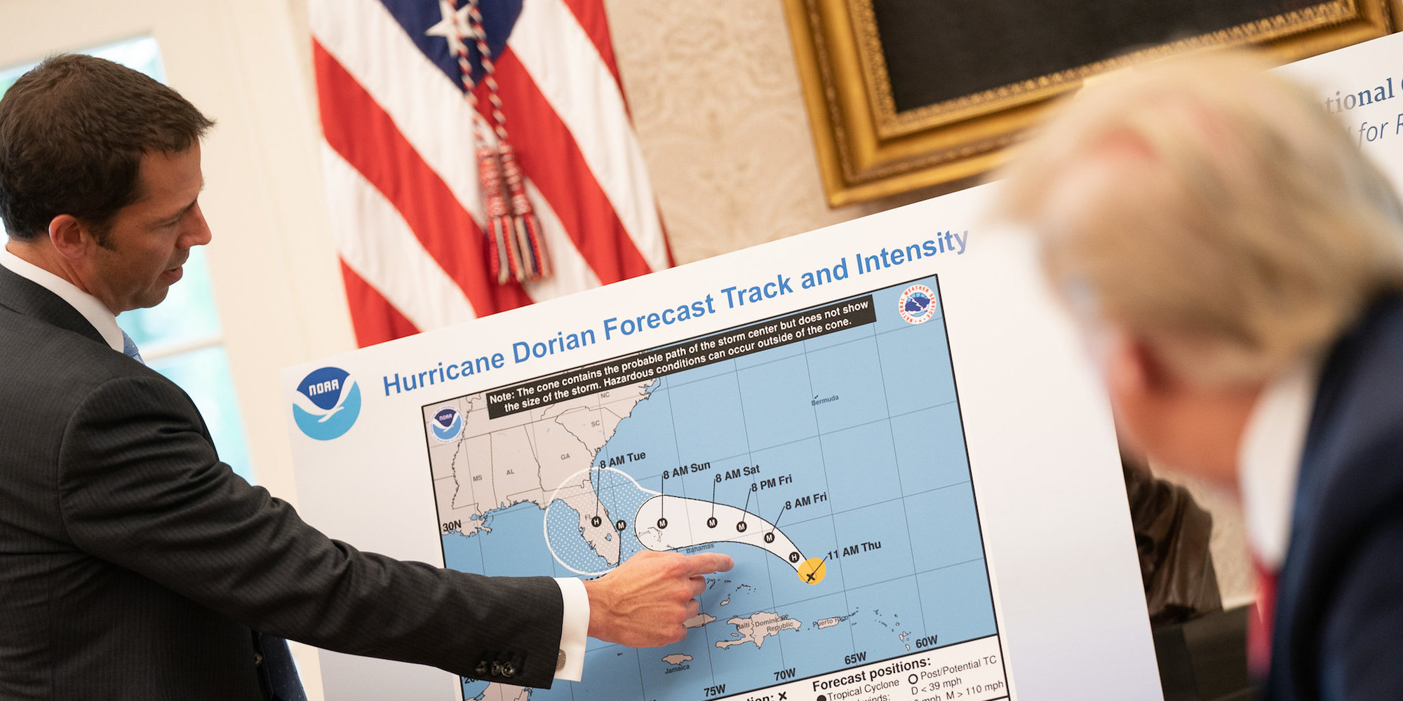
- A picture on the White House’s Flickr page shows President Donald Trump being briefed on an early projection of where Hurricane Dorian might go.
- Trump has insisted that early evidence suggested that Alabama could get hit. The map shows that in this briefing, that was not the case.
- On Wednesday, Trump produced the same map pictured in the briefing – but with the storm’s potential path extended via black pen into Alabama.
- Visit Insider’s homepage for more stories.
An official White House photograph shows that President Donald Trump was briefed on the likely progress of Hurricane Dorian with a map that did not show Alabama in its path.
The image, taken during an August 29 briefing and posted on the White House Flickr page, shows Trump receiving what was then the most up-to-date information on where Dorian was expected to head.
Trump later produced the same map in an altered form to support his false claim that Alabama was once thought to be in the storm’s path, as seen here:

Trump first claimed Alabama could get his in a tweet on Sunday, several days after the briefing in the photograph.
He said Alabama was among the states "most likely be hit (much) harder than anticipated" - despite the forecasts by then having moved even further from Alabama.
His suggestion prompted ridicule, and a swift correction from the National Weather Service. But Trump continued to insist that he had been right to make the claim.
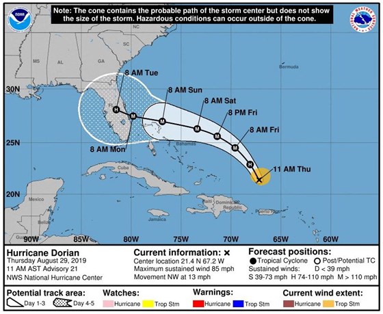
On Wednesday at an Oval Office press conference, Trump produced an altered version of the same map - Advisory 21, from 11 a.m. on Thursday, August 29. By then the map was six days out of date.
On the map, the storm's potential path had been extended with black pen to include Alabama.
"I know that Alabama was in the original forecast - they thought it would get a piece of it," Trump told reporters.
"We have a better map ... in all cases Alabama was hit, if not lightly in some cases pretty hard. They gave it a 95% chance."
Here is the original map from the NOAA showing Dorian's forecast trajectory.

When asked later about why the map had been changed, Trump replied: "I don't know. I don't know."
A White House spokesman, Hogan Gidley, later confirmed the map had been altered using a Sharpie marker pen.
Absolutely right @realDonaldTrump! Watching the media go ballistic over a black sharpie mark on a map would be hilarious if it weren’t so sad. The real news that matters here is a deadly hurricane continues up the coast and tens millions of Americans could be greatly impacted. https://t.co/SceSOeuyO5
— Hogan Gidley 45 Archived (@hogangidley45) September 5, 2019
The president may have even broken the law if the map was found to have been deliberately altered, as knowingly publishing counterfeit weather forecasts violates federal law.
Later, the president tweeted a map from the South Florida Water Management District dated August 28 that appeared to show some impact on Alabama from the storm.
In small print, the map said: "NHS Advisories and County Emergency Management Statements supersede this project. This graphic should complement, not replace, NHC discussions."
"If anything on this graphic causes confusion, ignore the entire product," the note said.
This was the originally projected path of the Hurricane in its early stages. As you can see, almost all models predicted it to go through Florida also hitting Georgia and Alabama. I accept the Fake News apologies! pic.twitter.com/0uCT0Qvyo6
— Donald J. Trump (@realDonaldTrump) September 4, 2019
An August 29 National Oceanic and Atmospheric Administration map did show a low probability of Alabama being affected by tropical-storm-force winds from Dorian.
On Monday, Trump had attacked a journalist for reporting on his misstatement about the hurricane's s trajectory, claiming that early evidence indicated Alabama would most likely be affected.
"Under certain original scenarios, it was in fact correct that Alabama could have received some 'hurt,'" he said.

