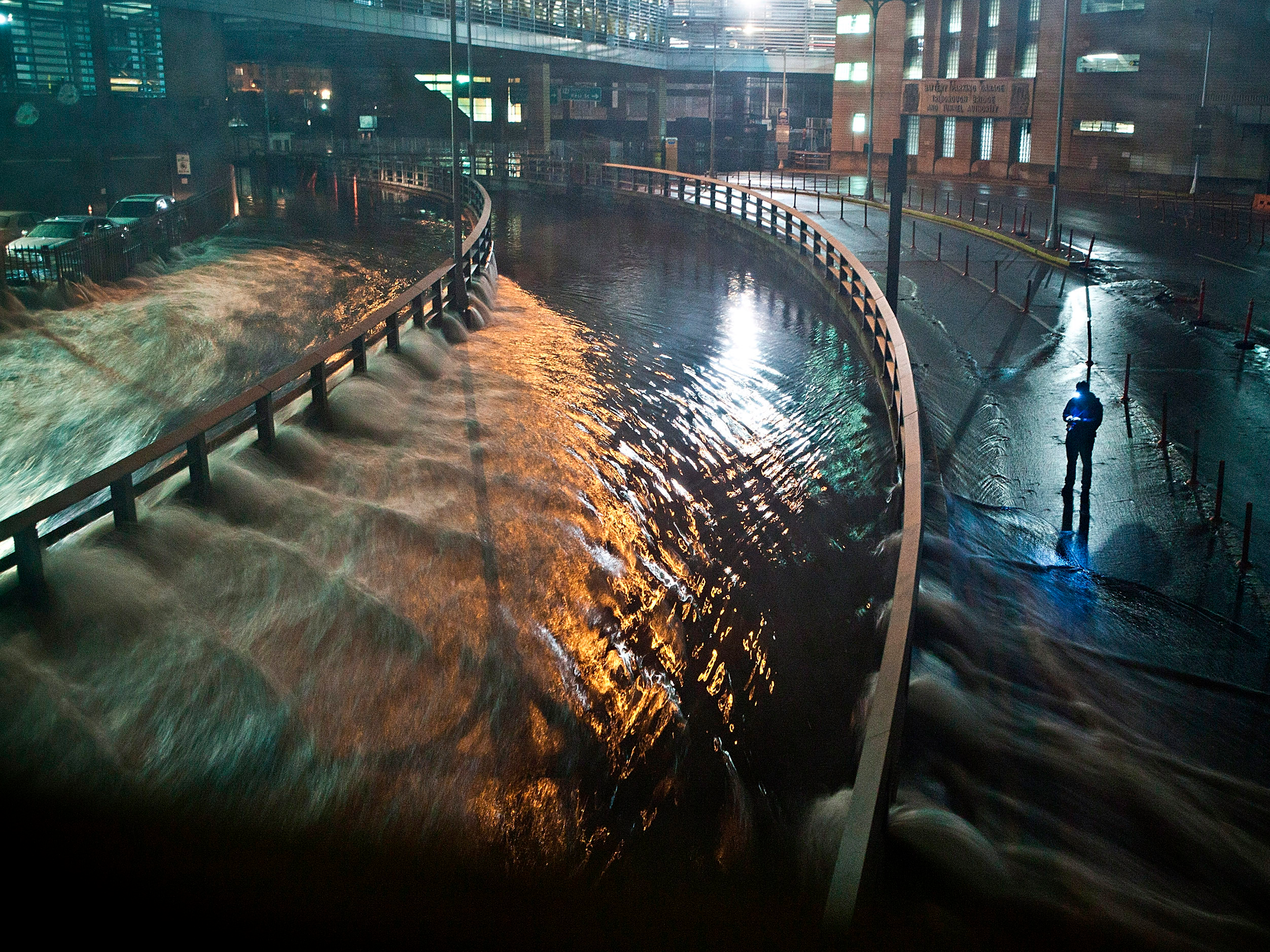
- Last year was the warmest on record for the planet’s oceans, and the fourth-warmest year ever for the Earth’s surface temperature.
- Scientists are discovering that Greenland and Antarctica’s ice sheets are melting much faster than they previously thought.
- Melting glaciers and warmer oceans will contribute to devastating sea-level rise in the next 80 years. If the worst-case projections are correct, US cities like San Francisco and New York – and their famous landmarks – could be underwater by 2100.
- Visit Business Insider’s homepage for more stories.
The more scientists study sea-level rise, the more daunting their predictions for coastal cities become.
A few years ago, the UN’s Intergovernmental Panel on Climate Change predicted that the world’s sea levels would rise an additional 3 feet by 2100. But earlier this week, a study in the Proceedings of the National Academy of Sciences more than doubled this worst-case estimate, predicting that sea levels could rise by around 6.5 feet in the same time frame.
Read more: 7 American cities that could disappear by 2100
For coastal cities like New York and San Francisco, this spells bad news for low-lying waterfront neighborhoods – and the many landmarks within them.
Climate Central's Google Earth plug-in shows what US cities would look like in the most extreme cases of sea-level rise. The tool estimates which areas of cities could be underwater by 2100 if sea levels were to rise by 8 feet - the worst-case projection from National Oceanic and Atmospheric Agency data.
Here are the major US cities and landmarks that could be underwater in 80 years.
No city is immune to the consequences of a warming world, but a few are more vulnerable than the rest. Sea-level rise is a considerable threat in San Francisco, for example, where some land has begun to sink due to excessive groundwater pumping.

Source: Climate Central Google Earth Plug-In
By the end of the century, the city's iconic Fisherman's Wharf could be underwater.
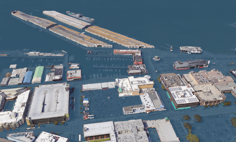
Under this extreme scenario, Fisherman's Wharf would no longer be accessible to its 12 million annual visitors.
Read more: Before-and-after images show how parts of San Francisco could be underwater by 2100
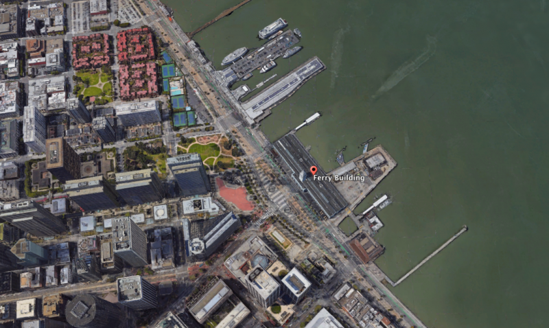
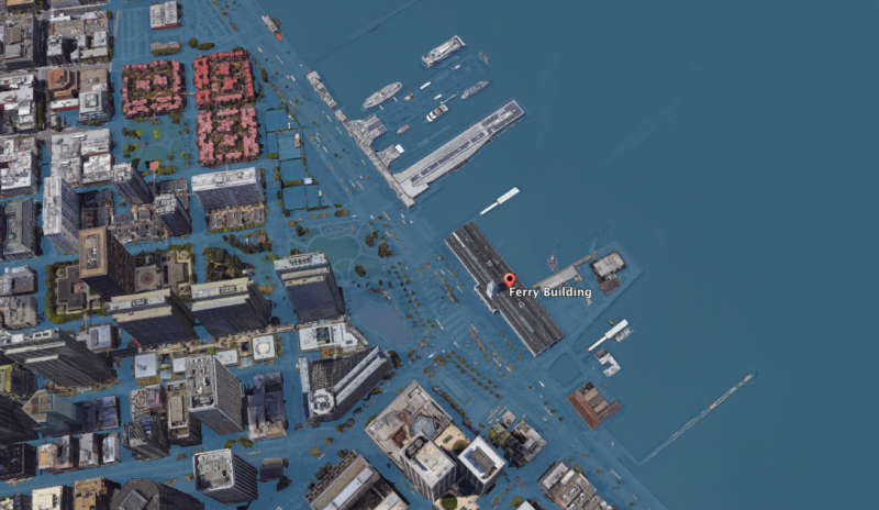
The city's Ferry Building has been around since the end of the 19th century.
Source: Climate Central Google Earth Plug-In
But it could be inundated by 2100, along with the rest of the Embarcadero, a popular area for tourists and locals.
Source: Climate Central Google Earth Plug-In
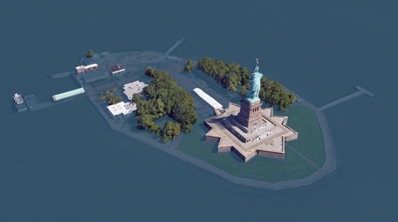
New York's Statue of Liberty doesn't stand much of a chance, either.

Source: Climate Central Google Earth Plug-In
Lady Liberty's 154-foot-tall pedestal may keep the statue from getting soaked, but the rest of Liberty Island could be submerged by 2100.
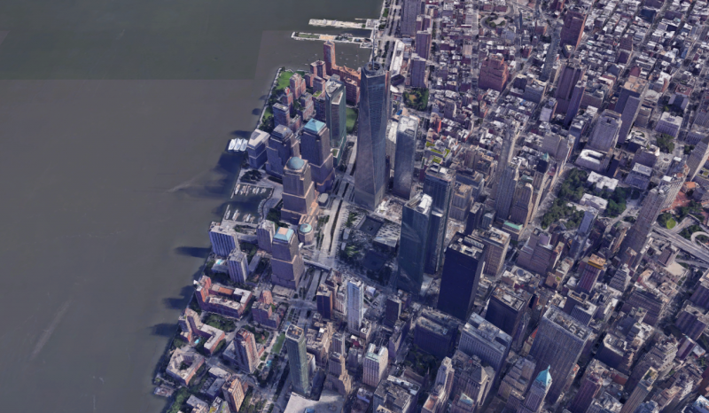
Construction workers are still putting the finishing touches on Manhattan's World Trade Center complex, which likely won't be complete for another few years.
Source: Climate Central Google Earth Plug-In
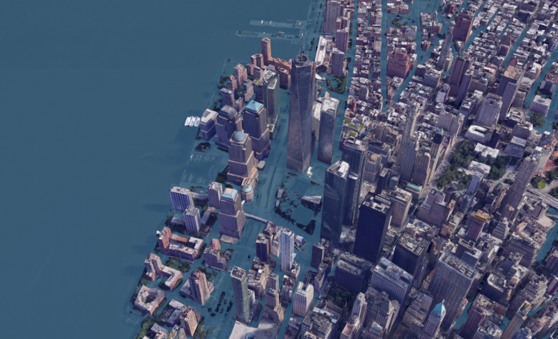
But the complex might be hard to reach without a boat 80 years from now.
Source: Climate Central Google Earth Plug-In
Boston's historical North End would cease to exist by 2100.
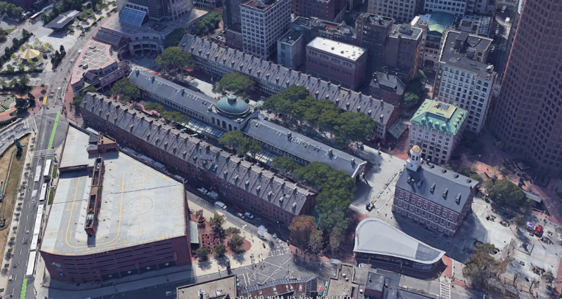
A 2016 Zillow report found that one out of every six homes in Boston could be underwater by 2100. The report used NOAA's conservative estimates (6 feet of sea level rise).
Extreme projections of sea-level rise put the city's historic Faneuil Hall underwater, along with other parts of the Freedom Trail.
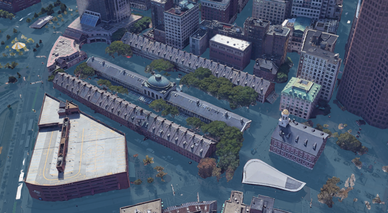
The NOAA estimates suggest that Boston will almost certainly see at least one flood with a depth of 6 feet or more by 2050.
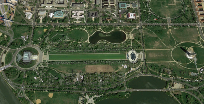
A number of Washington, DC monuments are in danger, too.
Source: Climate Central Google Earth Plug-In
Rising waters would inundate the Lincoln Memorial Reflecting Pool, though the memorial itself could remain unscathed.

Much of the National Mall, including the Washington Monument and Capitol Building, would also escape the worst effects of sea-level rise.
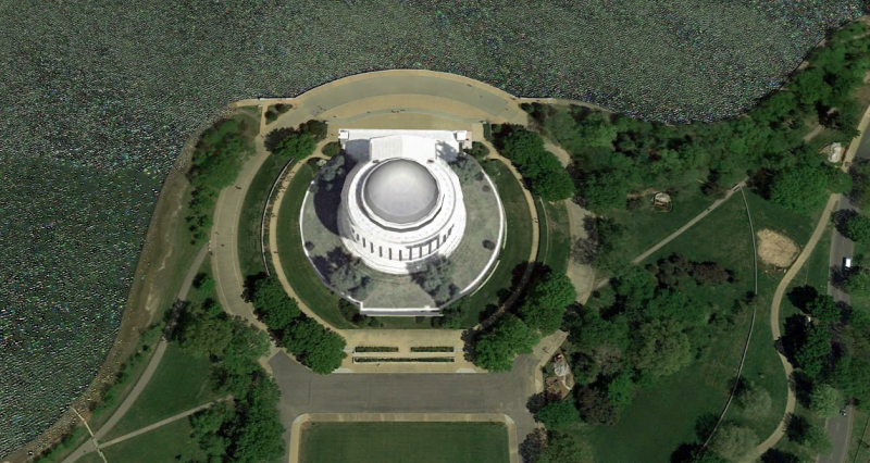
DC's Thomas Jefferson Memorial is in a more precarious position, since it's located along the Tidal Basin of the Potomac River.
Source: Climate Central Google Earth Plug-In
The memorial's entire platform is expected to be underwater.
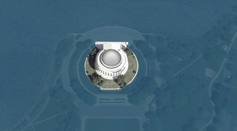
Source: Climate Central Google Earth Plug-In
Most neighborhoods in Charleston, South Carolina, could be underwater by 2100. That includes Fort Sumter, the site where the American Civil War began in 1861.
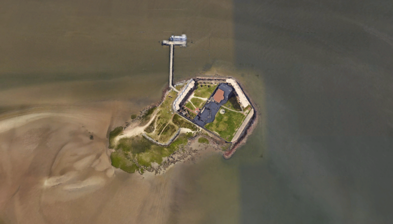
More than a decade ago, the Charleston City Paper predicted that the city could become "a half-drowned ghost town" by 2050. Under 12 feet of sea level rise, the paper reported, around 77% of the Charleston could be underwater.
Around 64,000 of Charleston's residents are at risk of coastal flooding in the next 100 years.
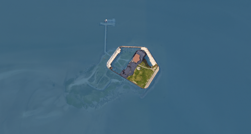
Source: Climate Central
Most of Atlantic City, New Jersey (along with parts of New York City) wound up underwater during Hurricane Sandy in 2012. The projections for 2100 are far worse.
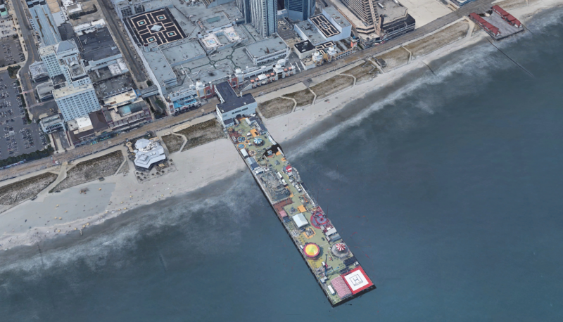
Hurricane Sandy left around 70% to 80% of Atlantic City underwater at the height of the storm. In some places, residents had to wade through water as deep as 8 feet.
The city's boardwalk, which includes the 1,000-foot-long Steel Pier amusement park, could be submerged 80 years from now.
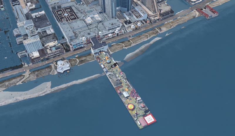
Research from Climate Central suggests that 37,000 people are at risk of coastal flooding in Atlantic City in the next century.
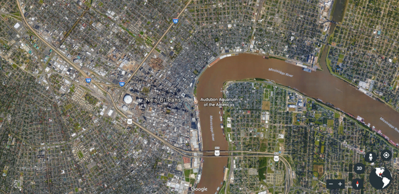
New Orleans is no stranger to the problems that come with sea-level rise. In 2005, Hurricane Katrina's storm surge flooded 80% of the city.
Source:Climate Central Google Earth Plug-In; NASA Earth Observatory
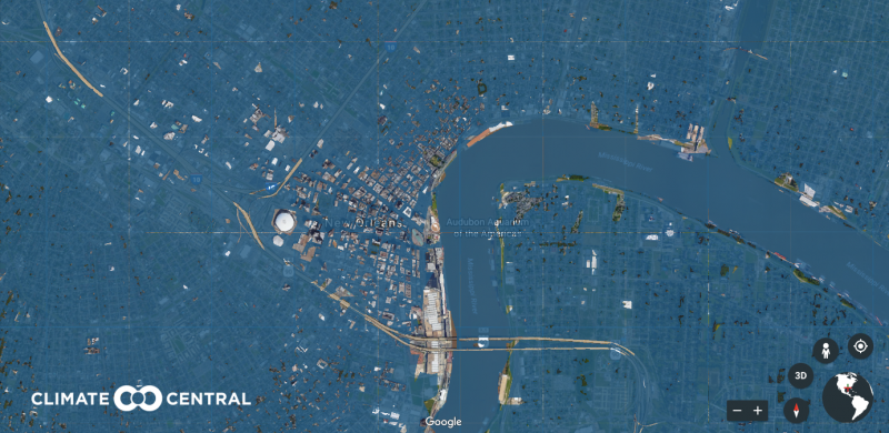
By 2100, the entire city could disappear under the rising water. An estimated 500,000 people may have to permanently leave their homes.
Source: Climate Central Google Earth Plug-In; Business Insider
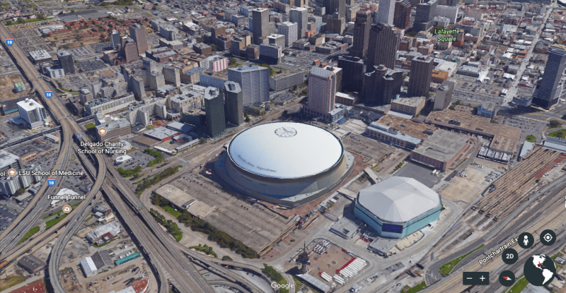
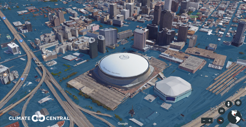
During Hurricane Katrina, tens of thousands of people sought refuge at the Mercedes-Benz Superdome, home of the New Orleans Saints.
Source: Climate Central Google Earth Plug-In
But even the arena might not escape extreme sea-level rise unscathed.
Source: Climate Central Google Earth Plug-In
The state of Florida is especially vulnerable to rising seas. If all of Greenland's ice were to melt at once, the water would submerge everything south of West Palm Beach.
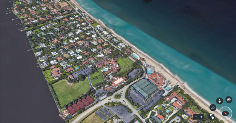
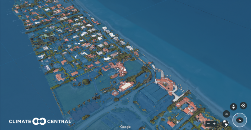
But even if Greenland's ice sheet remains intact, NOAA anticipates that Palm Beach, Florida could be wholly underwater by 2100.
Source: Climate Central Google Earth Plug-In
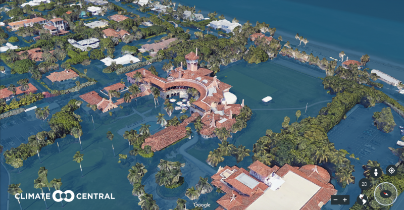
That spells bad news for President Donald Trump's Mar-a-Lago resort, which is sometimes referred to as the Winter White House.

Source: Climate Central Google Earth Plug-In
Under the worst-case scenario for sea-level rise, the greens and mansions of Mar-a-Lago could be completely submerged in 80 years.
