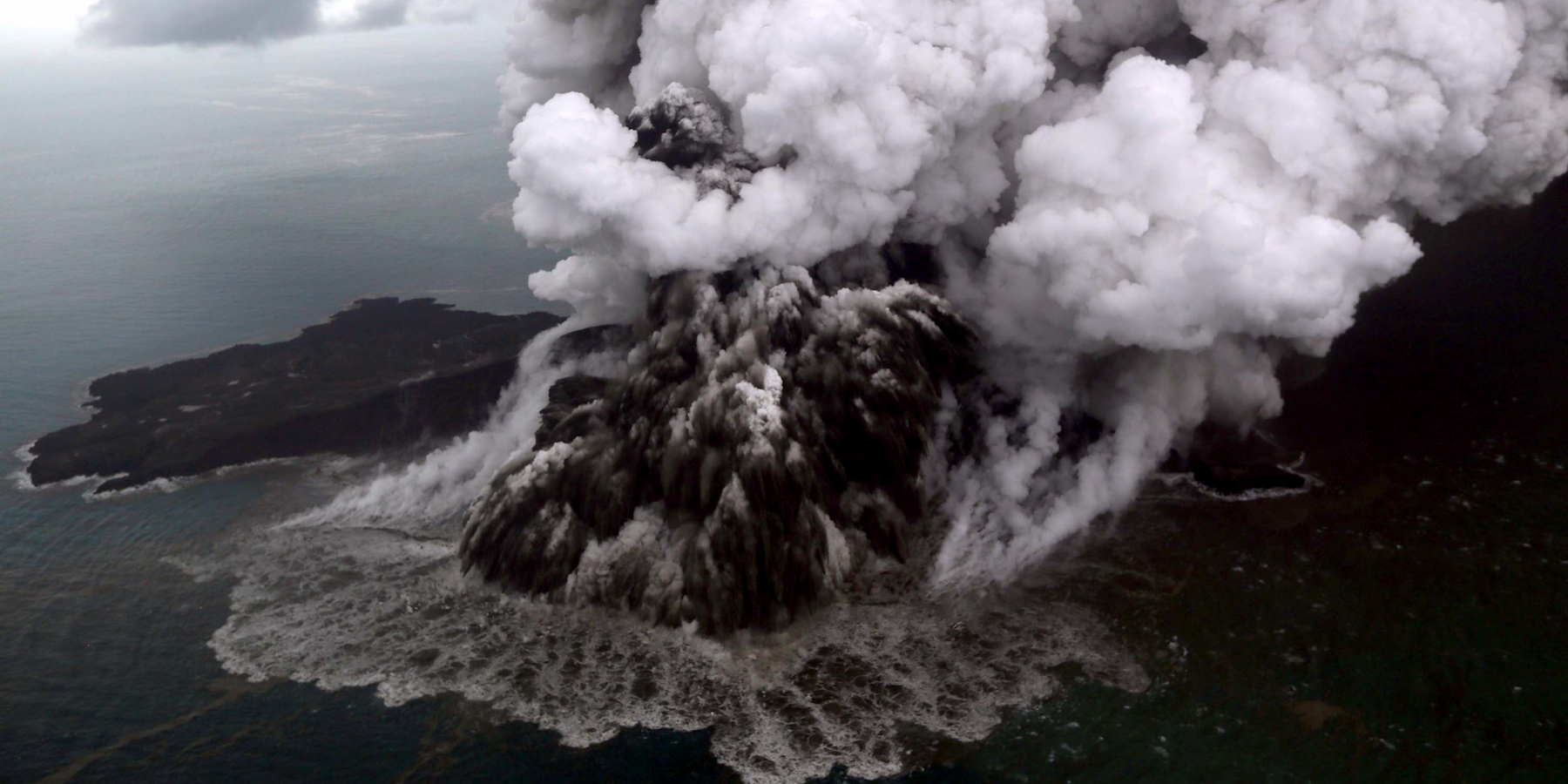
- Indonesian authorities warned of continued eruptions out of its Anak Krakatau volcano, which triggered a devastating tsunami earlier this week.
- The government told people to avoid the island’s 3-mile radius, and are rerouting flights.
- A crater on the volcano collapsed on Saturday, which caused an underwater landslide and a tsunami on coastal regions.
- At least 430 people are dead, and many others are injured or missing.
Indonesia ordered planes to stay away from the country’s airspace after one of its volcanoes partially collapsed, spouting volcanic ash into the atmosphere and triggering a devastating tsunami earlier this week.
A crater on the Anak Krakatau island volcano collapsed on Saturday, which caused an underwater landslide and sent waves of up to 16 feet high along coastal regions on the Sunda Strait between the islands of Java and Sumatra.

At least 430 people are dead, 1,495 are injured, and 159 are missing, according to Reuters.
Because a volcano and not an earthquake caused the disaster, authorities couldn't trigger a tsunami warning at the time. Coastal residents also reported not seeing or feeling warning signs before the tsunami hit on Saturday night.

Indonesia's disaster management agency (BNPB) on Thursday upgraded its alert level for the volcano to its second-highest level, warning in a statement that volcanic activity on the island volcano "continues to increase."
The volcano is still throwing up hot lava and volcanic ash, the BNPB added.
While the ash is not dangerous - and in fact "actually fertilizes the soil" - the agency said people should be "using masks and goggles when moving outside when it rains ash."
The BNPB also extended the danger zone from 2 km (1.2 miles) to 5 km (3 miles) around the island, and said: "People and tourists are prohibited from carrying out activities within a 5 kilometer radius of the crater peak of Mount Anak Krakatau."
Read more: Photos show the devastation from Indonesia's tsunami as the death toll rises

Dozens of flights rerouted
AirNav Indonesia, the country's traffic control agency, said it was closing flight routes to avoid the volcanic ash.
Between 20 and 25 flights were rerouted as of Thursday evening local time, including international routes to and from Australia, Singapore and the Middle East, the BBC reported.
The reroutes mean that passengers may experience longer journeys, and planes may require more fuel to power their trips, the BBC added.
The next phase of the volcanic eruption will involve incandescent - or extremely hot - lava mainly flowing to the island's southeast.

