NASA/JPL-Caltech/MSSS
- NASA's Perseverance rover on Mars snapped photos of cliffs that show signs of ancient flash floods.
- The first study of Perseverance's data suggests that a flooding river dragged boulders for miles.
- The photos also pinpoint ancient river sediment in which the rover could search for fossilized life.
In the dry Martian crater where NASA's Perseverance rover is searching for signs of long-gone life, torrential flash floods once dragged boulders for miles.
That's what researchers concluded in the first study of Perseverance's data since the rover landed on Mars in February.
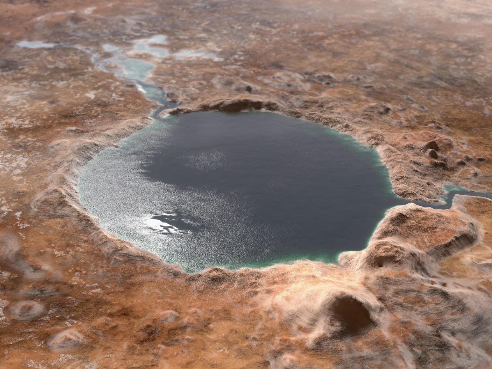
Its landing site, a 28-mile-wide crater called Jezero, was filled with water more than 3.5 billion years ago. Back then, a river spilled over the crater wall, carrying minerals and clay that could have trapped and fossilized ancient microbes at the bottom of Lake Jezero.
If such life ever existed on Mars, NASA scientists think they might find it in Jezero Crater, even though all the water has dried up. That's Perseverance's main mission there. As it explores the crater and the ancient river delta, it's collecting samples of rock, dirt, and ancient mineral deposits for a future mission to bring back to Earth.

NASA/JPL-Caltech
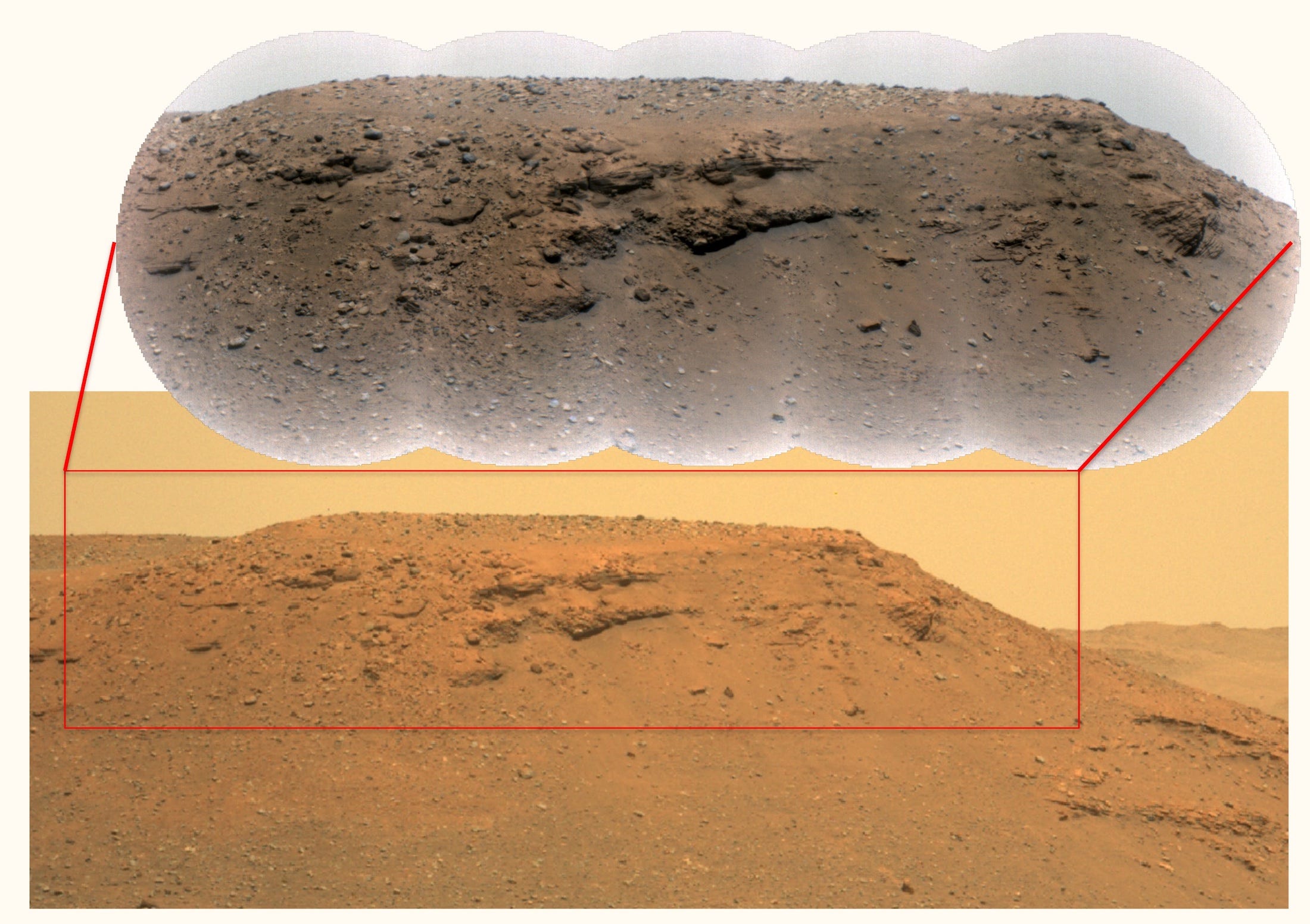
But as the rover treks toward the cliffs of the river delta, which it's set to explore in the coming months, its photos have revealed something strange. In the steep slopes, called escarpments, or "scarps," Perseverance spotted layers of large rocks and boulders.
"We saw distinct layers in the scarps containing boulders up to five feet across that we knew had no business being there," Nicolas Mangold, a Perseverance scientist in France who led the study, said in a NASA press release.
The cliffs were constructed over centuries, as river minerals fell to the bottom of the lake, building layer upon layer. In some of the higher layers, which correspond to periods later in the lake's history, groups of large boulders jut out from the mineral deposits. They're too large for any regular river to move - which means walls of raging water must have pushed them there.

RMI: NASA/JPL-Caltech/LANL/CNES/CNRS/ASU/MSSS Mastcam-Z: NASA/JPL-Caltech/ASU/MSSS
The researchers estimated that flash floods had to increase the river water to speeds as high as 20 mph in order to move such big rocks. Waters that powerful can drag boulders for tens of miles.
Perseverance's first study points where to look for life
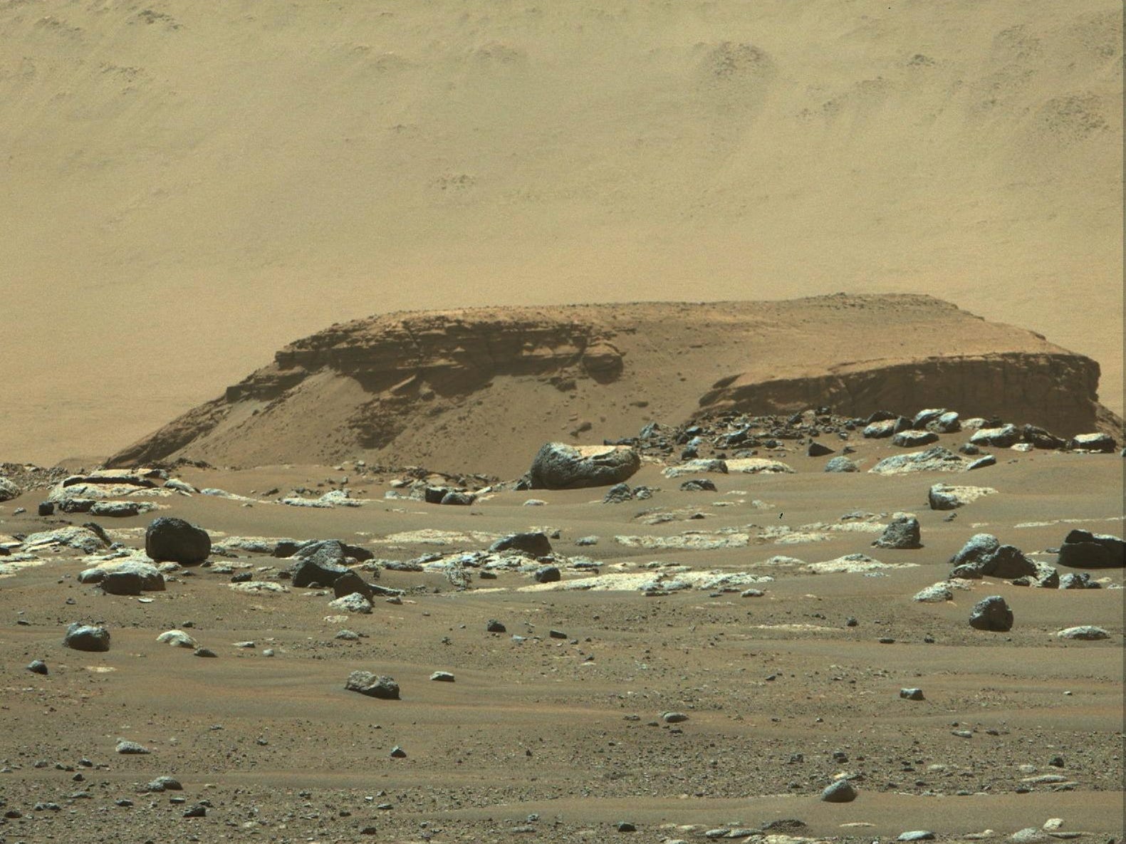
The study, published in the journal Science on Thursday, also analyzed Perseverance's images of a rock outcropping called Kodiak.
This mound, just over a mile from the rover, is a remnant of the river delta.

NASA/JPL-Caltech/ASU/MSSS
Along Kodiak's sides, horizontal layers of rock and mineral deposits are exposed. That layering, called stratigraphy, reveals the geological history of the region. And the layers look a lot like those left by river deltas on Earth.
"Never before has such well-preserved stratigraphy been visible on Mars," Mangold said. "This is the key observation that enables us to once and for all confirm the presence of a lake and river delta at Jezero. Getting a better understanding of the hydrology months in advance of our arrival at the delta is going to pay big dividends down the road."
These new findings may also help determine where Perseverance should look for fossils of ancient Martian microbes. The river carried grains that fell to the lake floor, eventually settling into sandstone or mudstone that became the bottom layers of the delta slopes. Those falling minerals could have trapped microbes.
"The finest-grained material at the bottom of the delta probably contains our best bet for finding evidence of organics and biosignatures," Sanjeev Gupta, a Perseverance scientist from Imperial College, London, and a co-author of the paper, said in NASA's press release. "And the boulders at the top will enable us to sample old pieces of crustal rocks. Both are main objectives for sampling and caching rocks."
But the new study also raises a big question. It's not clear what caused Jezero's flash floods. The researchers speculated that it could have been intense rainfall, rapid snow melt, or glacial activity. Figuring out the source of all that water would tell scientists a lot about the ancient Martian climate.
"We have no proof on Mars of the origin of these floods," Mangold told TIME. "That is something we want to be able to answer."

