Joe Raedle/Getty
- Hurricane Sally made landfall as a Category 2 storm near the city of Gulf Shores, Alabama, at 4:45 a.m. local time Wednesday.
- It has dumped 30 inches of rain on parts of Florida and Alabama, and soaking the Carolinas.
- On Wednesday night, Sally weakened to a tropical depression.
- Nearly 600,000 homes and businesses are without power across the southeastern US.
- One person in Alabama died, and another was reported missing.
- Visit Insider’s homepage for more stories.
Just weeks after Hurricane Laura struck Louisiana as a Category 4 storm, the US Gulf Coast took another hit.
Hurricane Sally made landfall as a Category 2 storm near the city of Gulf Shores, Alabama, at 4:45 a.m. local time on Wednesday. Gusts of wind exceeded 100 mph.
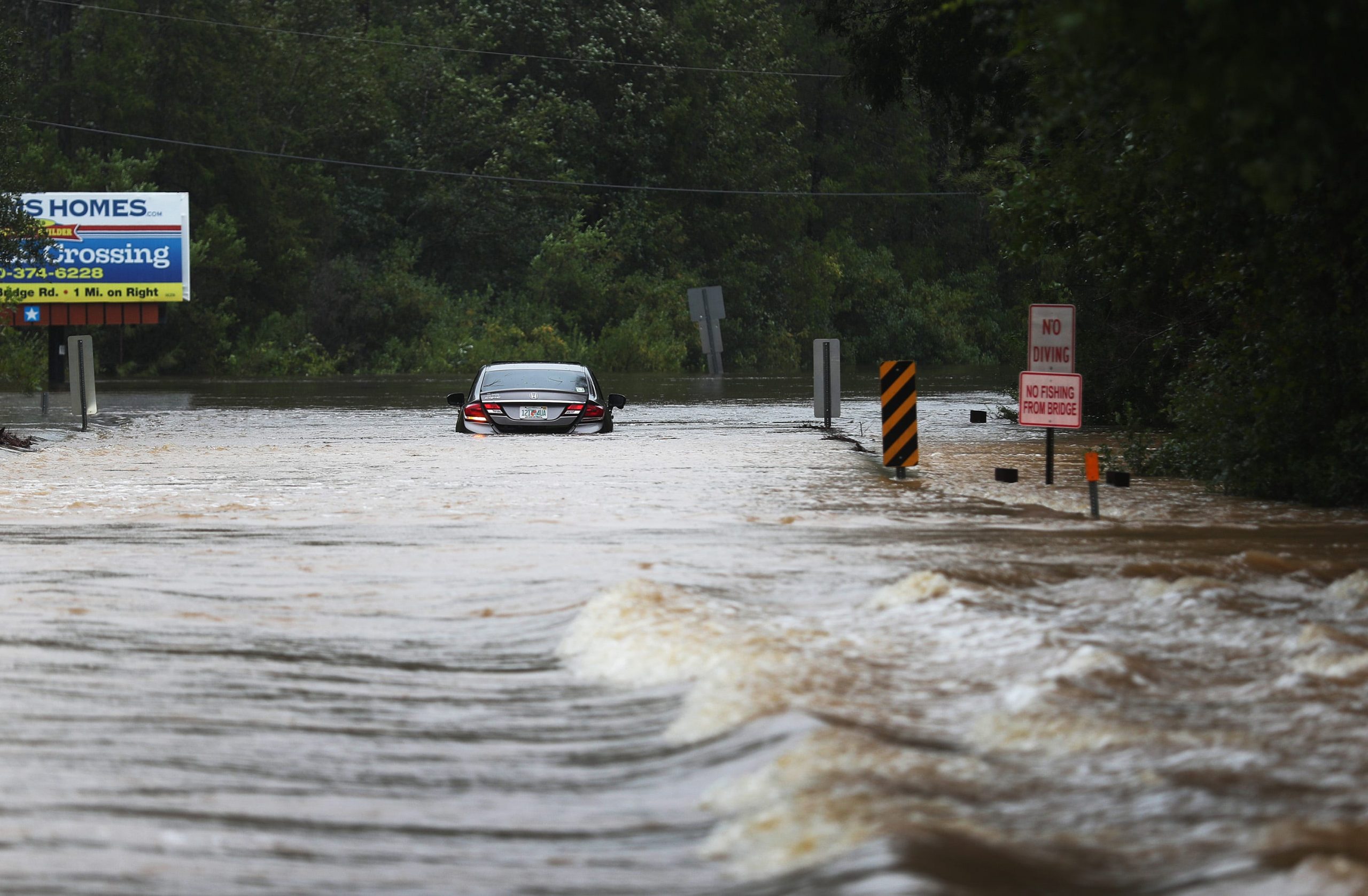
The storm then drifted northeast, dumping more than 2 feet of rain in areas between Mobile, Alabama, and the Florida panhandle.
“We had 30 inches of rain in Pensacola — 30-plus inches of rain — which is four months of rain in four hours,” Ginny Cranor, chief of the Pensacola, Florida, Fire Department, told CNN on Wednesday.
Parts of downtown Pensacola were completely submerged amid “historic and catastrophic flooding,” according to the National Hurricane Center (NHC).

Joe Raedle/Getty
By Wednesday evening, Sally had weakened into a tropical depression with 30 mile-per-hour winds.
But the NHC warns that a few tornadoes are still possible in parts of South Carolina on Thursday night as Sally moves northeast.
One Alabama resident died and nearly 600,000 homes and business were left without power
Hurricane Sally was the first hurricane to make landfall in Alabama since Hurricane Ivan in 2004.
The storm has left nearly 600,000 homes and businesses without power across the Gulf Coast, USA Today reported.
One Alabama resident died and another is missing, Orange Beach mayor Tony Kennon announced Wednesday.
In Florida, a chunk of the new Three Mile Bridge in Pensacola collapsed during the deluge when a barge smashed into it.
—Santa Rosa County Emergency Management (@SRC_EM) September 16, 2020
At least 377 people were rescued Wednesday after being trapped in flooded neighborhoods in Escambia County, which includes Pensacola, CNN reported.
Sally was moving very slowly when it made landfall Wednesday, trundling at speeds of 3 mph. That gave the storm more time to drop water, intensifying the resulting flooding.

Joe Raedle/Getty Images)
Nearly 90% of hurricane-related deaths result from rainfall flooding and storm surge, according to Weather.com.
Sally is one of 3 named storms in the southern Atlantic right now
The NHC is tracking two other named storms in the southern Atlantic Ocean.
In addition to Sally, there's Hurricane Teddy: a major Category 3 storm 610 miles east of the Lesser Antilles islands. Tropical Storm Vicky, meanwhile, weakened to a tropical depression on Thursday morning with winds of 35 mph.
Climate change makes hurricanes more frequent and devastating than they would otherwise be, since storms feed on warm water. Higher water temperatures also lead to sea-level rise, which in turn increases the risk of flooding during high tides and in the event of storm surges. What's more, warmer air holds more atmospheric water vapor, which enables tropical storms to strengthen and unleash more precipitation.
"Our confidence continues to grow that storms have become stronger, and it is linked to climate change, and they will continue to get stronger as the world continues to warm," James Kossin, an atmospheric scientist at the National Oceanic and Atmospheric Administration, told The Washington Post last month.
A warming planet also makes storms like Sally move more slowly, allowing them more time to lash an area with wind and dump more rain.
Climate scientist Michael Mann tweeted Wednesday that Sally was "moving slower than a turtle in peanut butter."
Over the past 70 years or so, the speed of hurricanes and tropical storms has slowed about 10% on average, according to a 2018 study. Over land in the North Atlantic and Western North Pacific specifically, storms are moving 20% to 30% more slowly.
