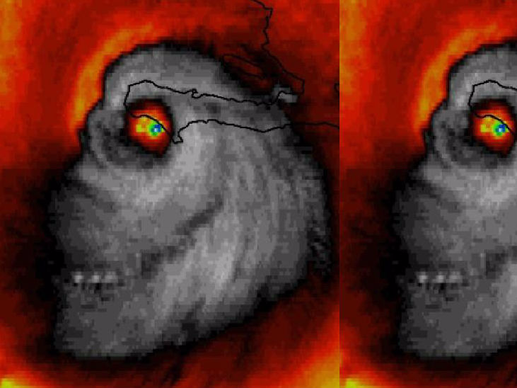
On Tuesday morning, Hurricane Matthew was making its way over western Haiti when senior meteorologist Stu Ostro saw something in the satellite images which was almost as scary as the storm itself.
He noticed a face appearing within the tropical cyclone. It looks a bit like the creepy, grinning profile of a skull.
Even without the spooky visuals, Hurricane Matthew ispretty scary on its own. It’s the first tropical stormto reach Category 5since 2007, with sustained wind of 130 mph. It’s also caused torrents of rain in Jamaica.
Sinister-looking face of #HurricaneMatthew at landfall in #Haiti [Un-doctored #weather #satellite image] pic.twitter.com/hrviDVuJ3R
— Stu Ostro (@StuOstro) October 4, 2016
WINK Morning meteorologist Matt Devitt also spotted the image while trying to do his weathercast.
SKULL OF MATTHEW: During my weathercast. This satellite image of Matthew's landfall is REAL. Freaky! Credit: @dewey_perez @CBSNews @CNN pic.twitter.com/EaFA3SSNRS
— Matt Devitt (@MattDevittWX) October 4, 2016
Hurricane Matthew left Haiti, leaving it in total disaster. At least five people have died there as a result of the storm, a bridge was destroyed, and phone communication was completely cut off from the areas it hit.
The storm reached Cuba on Tuesday, with some areas being invaded with massive 24-foot waves. Dozens of homes were destroyed in Cuba's most eastern city Baracoa.
Extreme damage from storm surge and category 4 force winds in Baracoa, Cuba. #HurricaneMatthew pic.twitter.com/E4BnfJQDL3
— Mike Theiss (@MikeTheiss) October 5, 2016
The storm has calmed slightly since then, being reduced to a Category 3, but it is set to reach Florida by Thursday evening.

