
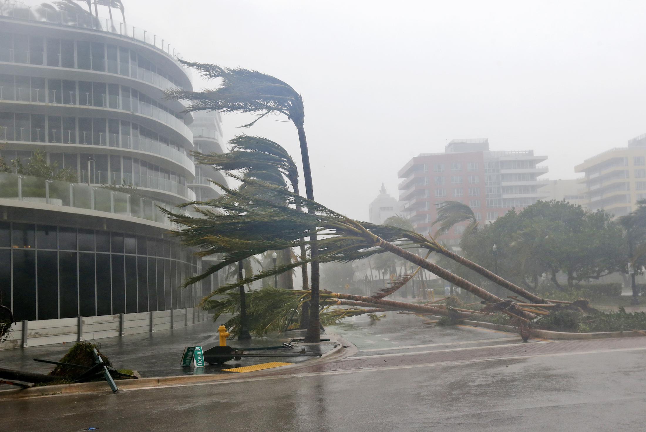
Hurricane Irma is lashing the Florida Keys and parts of South Florida with torrential rains, wind gusts in excess of 130 mph, and storm surges filling the streets.
At 9:10 a.m., the monster storm made landfall at Cudjoe Key, making this the first time on record that two Category 4 storms – Irma and Harvey – made landfall in the US in the same year. At 3:35 p.m., the Category 3 storm made another landfall in Marco Island on Florida’s west coast.
More than 1 million people in South Florida lost power before 10 a.m., before the worst of the hurricane forces even started to reach the mainland.
In the Keys, those still on the islands reported dire conditions.
"Everything is underwater, I mean everything," Larry Kahn, an editor or local news site FlKeysNews.com reported from a shelter in Marathon in the Middle Keys.
Some of those still on the islands, including staff with the National Weather Service still on site in Key West, have posted photos and videos showing what it's like on the islands:
From @chefdistilled Paul Menta of Key West First Legal Rum
Incredible as they take the eyewall #Irma @NWSKeyWest pic.twitter.com/2RLaxmMAlP— Jim Cantore (@JimCantore) September 10, 2017
Eyewall and Storm Surge !! #HurricaneIrma #KeyWest pic.twitter.com/jI9kItZWqJ
— Mike Theiss (@MikeTheiss) September 10, 2017
Despite warnings to get out of the Florida Keys, some people ignored them, including this man... pic.twitter.com/c8W3bLvahy
— CBS Mornings (@CBSMornings) September 10, 2017
Rough conditions north side of #KeyWest from #Irma. Our building is strong. Still no power. pic.twitter.com/8U1ULokmfJ
— NAS Key West (@NASKeyWest) September 10, 2017
Sunday afternoon, people in southern and western Florida started posting images of what it's like on the ground in places like Miami and Naples, as well:
Mast goes down then yacht sinks on https://t.co/r5sdnIWDkm @BayfrontParkMIA #StormSurge #HurricaneIrma @weatherchannel @andersoncooper pic.twitter.com/BjBb6iRqVi
— PTZtv (@PTZtv) September 10, 2017
1:45 pm. Surprised how vigorous winds in the rainbands of this thing are. Worst to come. 978 mb. #IRMA #Naples pic.twitter.com/CkqaCtJ8Xj
— Josh Morgerman (@iCyclone) September 10, 2017
Nasty storm surge along #Brickell Bay drive. @nbc6 #Irma pic.twitter.com/OCcXhMZw99
— Amanda Plasencia (@AmandaNBC6) September 10, 2017
This is Miami right now. #HurricaneIrma pic.twitter.com/bhVqJ1bmCP
— Ryan Fournier (@RyanAFournier) September 10, 2017
https://twitter.com/Breaking911/status/906961494985904129
'Do not venture outside'
In the latest forecast, the National Hurricane Center warned of venturing outside when things seemed to have calmed.
"Do not venture outside when the calm eye of the hurricane passes over, as dangerous winds will return very quickly when the eye moves away," forecasters wrote.
The city of Miami announced there would be a curfew from 6 p.m. on Sunday until 7 a.m. on Monday.
As Irma moves on from the Keys, the storm is expected to make its way up the west coast of Florida - though the hurricane is large enough that wind and rain could stretch across the entire state. Major population centers like Tampa are still in the hurricane's direct path.
William South, manager of the NWS Tropical Weather Program, explained in The Washington Post that staff stayed in their 220 mph-certified bunker so they'd be able to monitor conditions and weather radar, communicate with emergency responders, and save lives.
"As I watch Irma progress, I increasingly fear what the aftermath is going to look like," he wrote. "When the worst of Irma passes and we emerge from the bunker, perhaps Monday, I hope I see the beautiful island I'm familiar with, and not just flat devastation stretching out to the sea. But whatever we find when we open those doors, we'll be here."
Communications are down for @NWSKeyWest. All staff are safe, building is okay, and operations are being backed up by @NWSSanAntonio
— National Weather Service (@NWS) September 10, 2017
Just after 3 p.m. ET on Sunday, the Key West NWS office "lost the ability to communicate and transmit alerts," prompting the San Antonio office to take over.