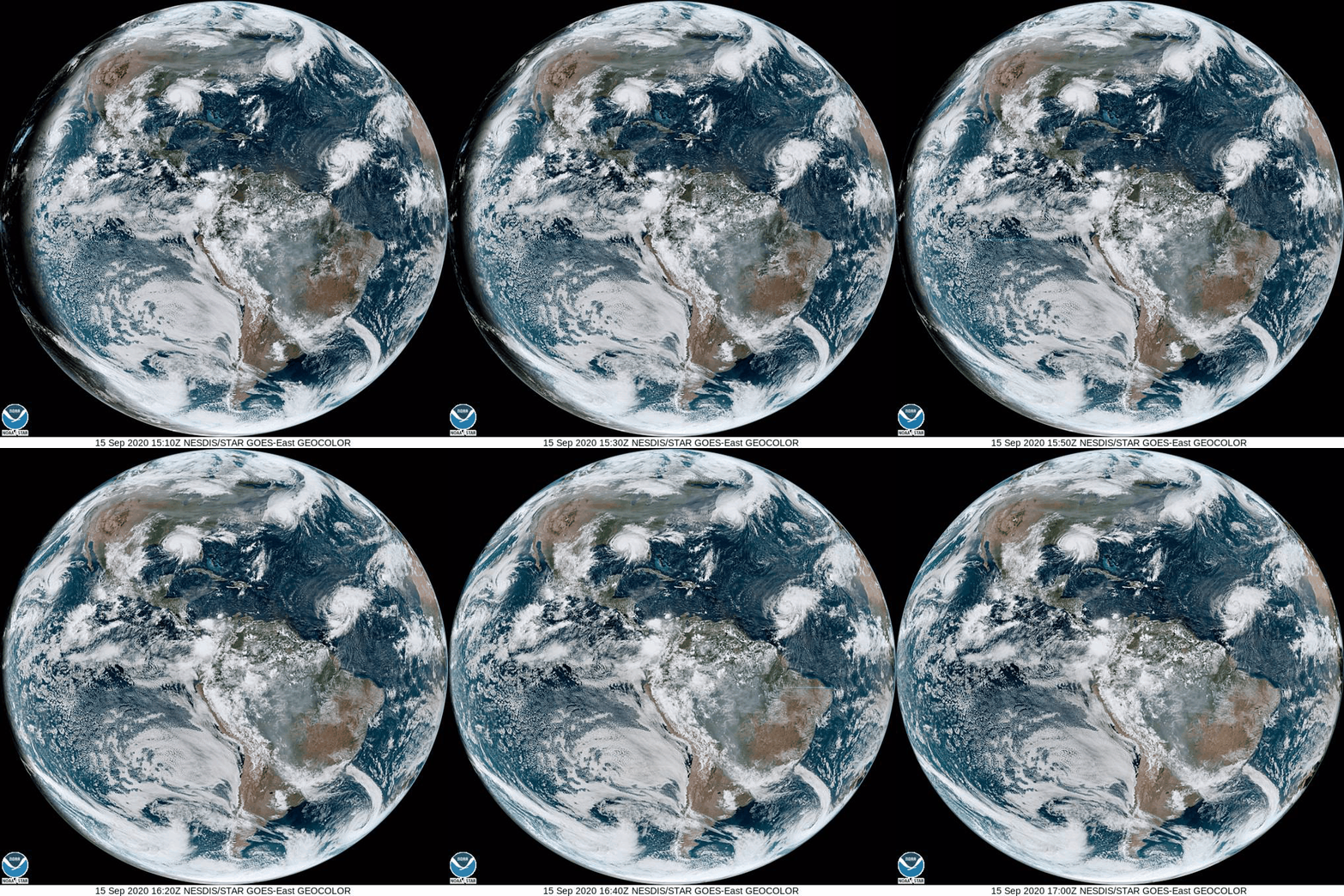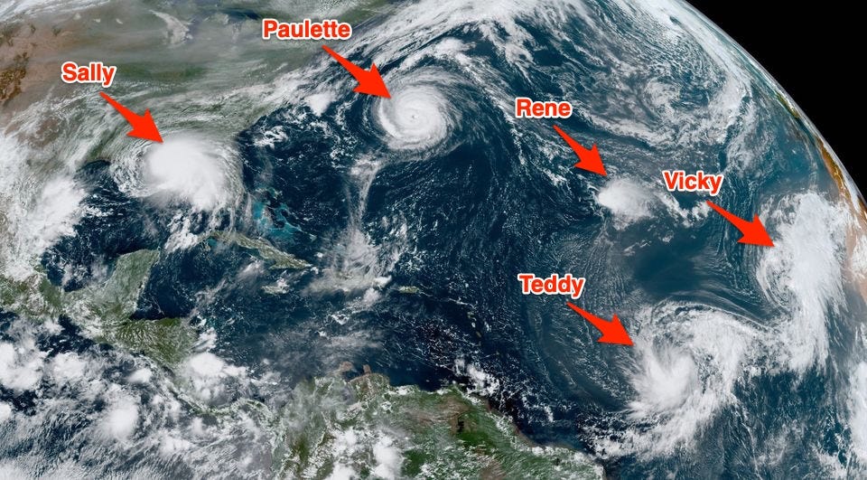
- A shocking satellite image shows five tropical cyclones churning in the Atlantic basin, which includes the Atlantic Ocean, the Caribbean, and the Gulf of Mexico.
- The cyclones tie yet another record in an extremely active hurricane season.
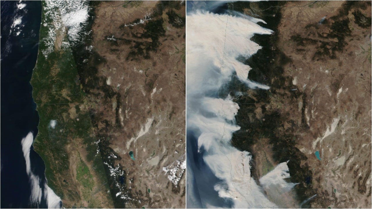
- The image also captures smoke swirling across the US from historic wildfires in California, Oregon, and Washington.
- Climate change is making both wildfires and hurricanes more extreme.
- Visit Insider’s homepage for more stories.
An astonishing satellite photo shows five tropical cyclones swirling in the Atlantic basin at once.
The National Oceanic and Atmospheric Administration’s Geostationary Operational Environmental Satellite (GOES) captured the image on Monday afternoon. It shows Tropical Depression Rene, Tropical Storms Teddy and Vicky, and Hurricanes Sally and Paulette.
“This ties the record for the most number of tropical cyclones in that basin at one time,” the National Weather Service tweeted on Monday.
The Atlantic Ocean, Caribbean, and Gulf of Mexico have only held this many storms once before, in September 1971.
Tropical Depression Rene dissipated Monday night, but the four other storms in the image persist. Here’s what the satellite imagery showed Tuesday morning:

Hurricane Sally is currently churning towards Louisiana and Mississippi, where the NHC expects it to bring "historic, life-threatening flash flooding."
The cluster of cyclones in the Atlantic comes at the peak of hurricane season, which has been especially active so far this year, with 20 named storms. Only one name — Wilfred — remains on the list of 2020 Atlantic cyclone names. If the National Hurricane Center runs out of conventional names, it will have to start using the Greek alphabet.
A warming climate makes hurricanes (and fires) more extreme
The satellite images from Monday and Tuesday also show smoke swirling towards the East Coast from the unprecedented wildfires in California, Oregon, and Washington.
Experts attribute both the unprecedented scope of the fires and the overly active hurricane season to climate change.

NASA Worldview
In the case of the fires, longer and more severe dry seasons fuel larger fires, which can start earlier and last later into the year.
In the Atlantic basin, warming waters and air are making hurricanes stronger, slower, and wetter.
Tropical cyclones feed on warm water. Higher water temperatures also lead to sea-level rise, which in turn increases the risk of flooding during high tides and in the event of storm surges. What's more, warmer air holds more atmospheric water vapor, which enables tropical storms to strengthen and unleash more precipitation.
In a recent study, researchers found that each new decade over the last 40 years has brought an 8% increase in the chance that a storm turns into a major hurricane.
"Almost all of the damage and mortality caused by hurricanes is done by major hurricanes," NOAA atmospheric scientist James Kossin, who led the study, told CNN. "Increasing the likelihood of having a major hurricane will certainly increase this risk."
